

The Singapore Postal Code System: Structure, History, and Urban Precision
Singapore operates one of the most precise and efficient postal code systems in the world, utilizing a six-digit numeric format administered by Singapore Post (SingPost). Introduced on September 1, 1995, to replace an earlier four-digit system, the six-digit postal code was specifically engineered to support automated mail sorting and pinpoint individual buildings across the densely urbanized island nation.
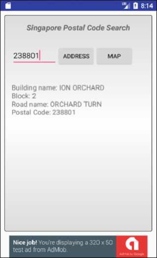
Under this modern system, virtually every residential block, commercial office tower, industrial building, and landed property in Singapore is assigned its own unique six-digit postal code. Because each code corresponds directly to a specific delivery point rather than a broad neighborhood, a recipient’s address in Singapore can often be accurately identified using only a unit number and the six-digit postal code—a level of geographic granularity rarely matched by postal networks elsewhere.
The six-digit structure follows a systematic, logical hierarchy designed for rapid sorting and geographic orientation. The first two digits represent the postal sector, which divides Singapore into 82 distinct geographic zones numbered from 01 to 82 (excluding 74). These sectors correspond to traditional postal districts established during the colonial era. For example, sectors 01 through 06 cover the Central Business District (Raffles Place, Cecil, Marina, and Shenton Way), sectors 22 and 23 encompass Orchard Road and River Valley, while sectors 51 and 52 serve the eastern town of Tampines.
The final four digits pinpoint the exact delivery point within that postal sector. For Housing & Development Board (HDB) public housing estates, the system incorporates an intuitive numbering convention: the final three digits of the postal code frequently mirror the actual block number of the building, while the third digit distinguishes between different street names within the same sector. For instance, Block 123 along a specific avenue might hold a postal code ending in 123, making it remarkably easy for postal workers, delivery drivers, and emergency services to locate properties swiftly.
Historically, Singapore’s postal framework has evolved alongside its rapid urban transformation. Prior to 1979, Singapore used a simple two-digit postal district system covering 28 districts. As high-rise public housing estates proliferated across the island in the 1970s, authorities introduced a four-digit system in 1979 to expand sorting capacity. By the mid-1990s, continued vertical urban density and the adoption of high-speed optical character recognition (OCR) sorting machines necessitated the transition to the current six-digit model, which offers one million possible numeric combinations.
Beyond conventional mail delivery, Singapore’s six-digit postal code serves as a foundational piece of digital and civic infrastructure. It powers real-time e-commerce logistics, GPS navigation, ride-hailing dispatch systems, emergency response routing, and municipal demographic mapping. In a compact, high-density city-state where efficiency is paramount, the six-digit postal code stands as a model of modern urban organization.
Leave a Reply