
Cartography of a Sovereign City-State: Understanding the Map of Singapore
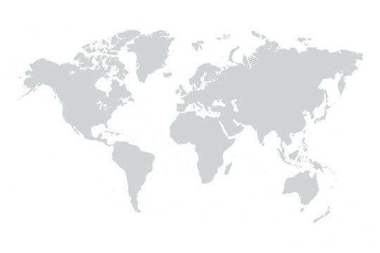
At a casual glance on a standard world map, the Republic of Singapore appears as little more than a tiny dot anchored at the southern tip of the Malay Peninsula. Yet, zooming in on the map of Singapore reveals a remarkably intricate, meticulously engineered geography that tells the story of a nation’s survival, economic ingenuity, and visionary urban planning. Spanning roughly fifty kilometers from east to west and twenty-seven kilometers from north to south, Singapore’s cartography is defined by its strategic maritime chokepoint, its dramatic transformation through decades of land reclamation, and its highly structured division into functional urban regions, green corridors, and offshore islands. Exploring the map of Singapore offers profound insight into how one of the world’s smallest nations maximizes every square meter of its sovereign territory.
Strategic Maritime Geography
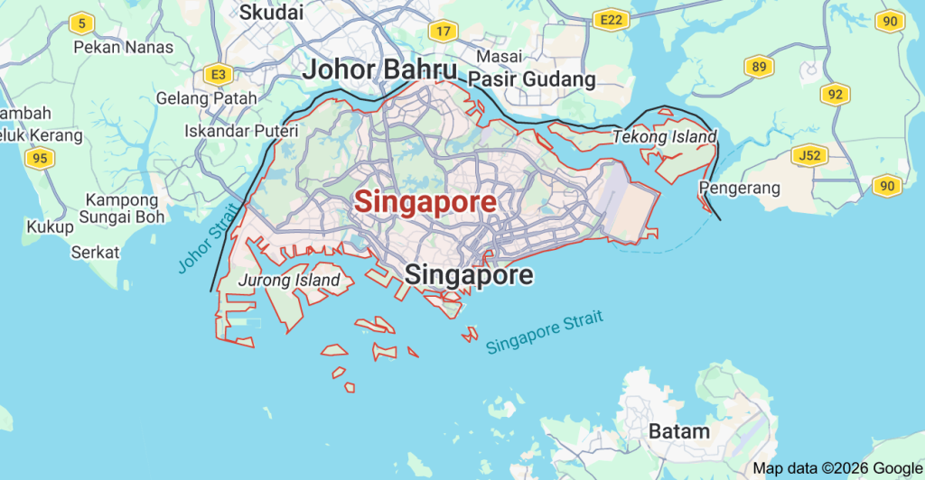
To understand Singapore’s map is to understand its geopolitical destiny. Situated approximately one degree north of the equator, Singapore lies at the southern terminus of the Strait of Malacca, one of the busiest and most vital maritime shipping lanes on Earth. Separated from Peninsular Malaysia to the north by the narrow Straits of Johor—and linked by two overland crossings, the Johor–Singapore Causeway in the north and the Malaysia–Singapore Second Link in the west—Singapore also faces the Indonesian Riau Islands across the Singapore Strait to the south.
This precise geographic coordinate transformed Singapore from a quiet fishing settlement into a premier British colonial trading port in 1819, and subsequently into a global maritime and aviation powerhouse. On a regional map, Singapore sits within a four- to seven-hour flight radius of nearly half the world’s population, cementing its status as an indispensable hub for international trade, finance, and logistics.
The Expanding Map: Decades of Land Reclamation
Perhaps the most extraordinary feature of Singapore’s map is that its physical coastline is not static; it has been deliberately and continuously redrawn over the past six decades. Upon gaining independence in 1965, Singapore possessed a total land area of roughly 581.5 square kilometers. Constrained by finite territory and an expanding population and economy, the government embarked on an ambitious, scientifically managed program of land reclamation.
Using imported sand and earth excavated from local hills, Singapore extended its coastlines outward into shallow surrounding waters, expanding its total land area by more than twenty-five percent to over 735 square kilometers today. Prominent landmarks that define modern Singapore’s map—including Marina Bay, Changi Airport, East Coast Park, Jurong Island (formed by merging seven smaller offshore islands into a unified petrochemical hub), and the massive Tuas Mega Port in the far west—sit entirely on reclaimed land. Looking ahead, long-term coastal engineering projects such as the “Long Island” initiative along the southeastern coast aim to both generate new urban land and protect low-lying areas from rising sea levels.
Administrative Regions and Urban Zoning
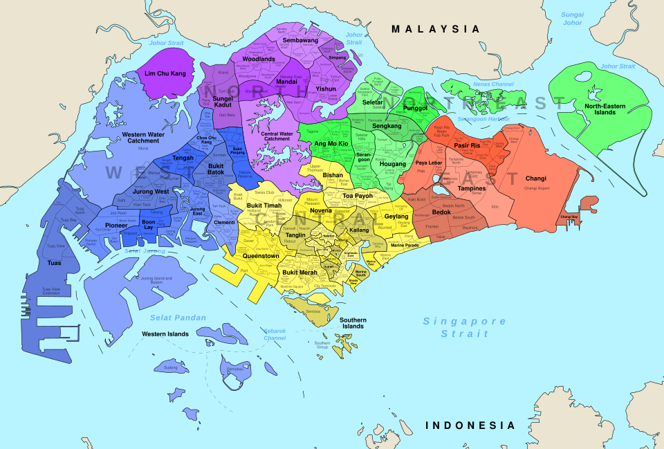
Unlike larger countries divided into states or provinces, Singapore operates as a unitary city-state whose map is organized by the Urban Redevelopment Authority (URA) into five overarching planning regions, further subdivided into fifty-five planning areas:
- The Central Region: Serving as the historic, commercial, and administrative core of the nation, this region encompasses the Central Business District (CBD), Marina Bay, the civic district along the Singapore River, Orchard Road, and vibrant cultural enclaves such as Chinatown, Little India, and Kampong Gelam.
- The East Region: Dominated by residential towns such as Tampines, Bedok, and Pasir Ris, the East Region is anchored by Changi Airport on its eastern edge and bordered by the popular recreational beaches of East Coast Park.
- The West Region: Functioning as Singapore’s industrial, technological, and academic powerhouse, the West houses the Jurong industrial estates, the Jurong Lake District, the Tuas port complex, Nanyang Technological University, and the National University of Singapore.
- The North Region: Characterized by mature residential towns like Woodlands and Yishun, the North serves as the primary overland gateway to Johor Bahru, Malaysia, while also preserving vast agricultural pockets and the Mandai wildlife precinct.
- The North-East Region: Encompassing rapidly growing, family-oriented residential towns such as Sengkang, Punggol, Hougang, and Ang Mo Kio, this region exemplifies modern high-density sustainable housing integrated with coastal waterways.
The Green and Blue Network
A topographical or satellite map of Singapore highlights a striking contrast between dense urban infrastructure and lush tropical greenery. Guided by its “City in Nature” master plan, Singapore protects nearly half of its surface area as green space, reservoirs, and nature reserves.
At the geographic center of the island lies the Central Catchment Nature Reserve, Singapore’s largest tract of primary and secondary rainforest, which surrounds four major freshwater reservoirs: MacRitchie, Upper Peirce, Lower Peirce, and Upper Seletar. Further west, the Bukit Timah Nature Reserve protects the island’s highest natural peak, Bukit Timah Hill, standing at an elevation of 163.63 meters. Connecting these parks is the Park Connector Network (PCN) and the Rail Corridor, a 24-kilometer continuous green artery running north-to-south along the former Keretapi Tanah Melayu railway line.
Offshore Islands
Beyond the main diamond-shaped island of Pulau Ujong, the map of Singapore encompasses sixty-four smaller offshore islands, each serving distinct recreational, industrial, or ecological purposes:
- Sentosa: Located just off the southern coast, Sentosa is a world-renowned resort island featuring theme parks, beaches, and marinas.
- Pulau Ubin: Situated in the northeastern Straits of Johor, this granite island offers a rare glimpse into 1960s kampong (village) life, wetland habitats, and rustic cycling trails.
- The Southern Islands: Comprising St. John’s Island, Lazarus Island, Kusu Island, and Sisters’ Islands, this tranquil archipelago is prized for marine biodiversity conservation, coral reefs, and quiet coastal getaways.
- Pulau Tekong and Pulau Semakau: Pulau Tekong serves as a dedicated military training base for Singapore’s National Service recruits, while Pulau Semakau operates as an acclaimed, ecologically engineered offshore landfill transformed into a thriving mangrove and bird sanctuary.
Conclusion
The map of Singapore is far more than a navigational tool; it is a living blueprint of human ingenuity and foresight. Every highway corridor, reclaimed waterfront, residential new town, and protected nature reserve reflects decades of deliberate spatial planning aimed at balancing economic vitality with environmental stewardship. For travelers, urban planners, and historians alike, studying the map of Singapore reveals how a tiny island nation sculpted its own geography to secure a prosperous and sustainable future.
Leave a Reply